Is it Occupied?
Is it occupied?
An interactive map to help users gauge the occupancy of study rooms and meeting rooms.
—
School project // 2014
concept, UX, visual design, Arduino prototyping
My role
Sole designer. Product vision, interaction design, visual design, Arduino prototyping.
The Challenge
Students at the University of Michigan often require the use of study rooms. Some study rooms may be reserved, while others are first come, first serve. In order to find an open study room, students resort to wandering around from floor to floor, checking to see if any rooms are available. This process can be frustrating, time consuming, and fruitless.
The Outcome
An interactive map, placed at a convenient, accessible location, will serve as an ambient tool to help users gauge the occupancy of various locations, including study rooms, meeting rooms, public spaces, etc. This way, students may make faster, more informed decisions regarding where to meet or study.
Product vision
In a real world situation, the map would be installed in a publicly accessible area and accurately depict the occupancy state of all rooms, spaces, etc.

Target audience
For now, the "Is it occupied?" map is targeted towards university students looking for study spaces. However, the concept may be expanded towards a more generalized audience to include public spaces, offices, restaurants, theaters, etc.

Prototype + Demo
In order to demonstrate the proof of concept, I prototyped a smaller scale room occupancy map using LEDs, Arduino, and foam core.
room occupancy map

The LEDs include green for vacant, red for occupied, and blue for uncertain. In a world where no sensors are 100% accurate in predicting situational context, one must design for graceful degradation. Hence, the blue state.
demo installation
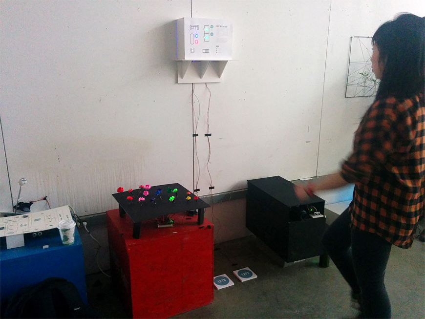
The prototype demo depicts a proxy for what a large scale room occupancy map could be. A floor plan is mounted on a wall, with LEDs indicating different occupancy states.
Floor mats

Floor mats are connected with FSR sensors to read pressure and determine whether the "room" is occupied or not. In a real world situation, these prototypical floor mats would cease to exist. Instead, various force, movement, and heat sensors would be deployed in individual rooms and spaces themselves.